From the early days of scientists looking at the environment in new ways from a hot air balloon to the current trend of aerial drones, mapping gives us an opportunity to view our world in a way no other technology can. It helps us visualize data in unique and informative ways, it helps us understand spatial and temporal relationships, and allows us the opportunity to look at the world around us, and our relationship with it, in ways which can span from scientific to artistic.
Maps and their symbols are embedded in our society, just take a look around next time you go for a drive, all those signs originated from “cartography”, the study and practice of. making maps. Cartography supports all of the Kenai Watershed Forum’s other endeavors, including research, restoration, and education, and we maintain an exhaustive mapping database through the use of ESRI’s Geographic Information System (GIS).
For More Information about the Kenai Watershed Forum’s mapping program please scroll down to see individual project highlights and interactive mapping opportunities or contact: ben@kenaiwatershed.org.
Project Highlights
National Hydrography Dataset
Since 2011 the Kenai Watershed Forum has been a leader in updating the USGS National Hydrography Dataset , or NHD. Water is fundamental to our mission and it all begins with knowing where and how accurately depicted our waters are.
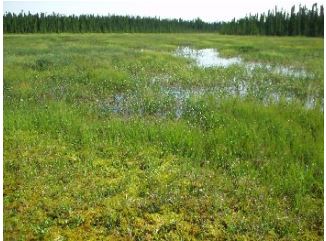
Wetland Assessments
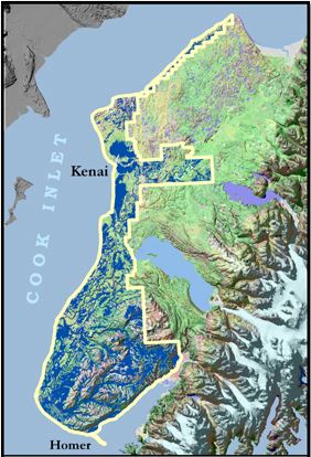
Wetlands are regulated under section 404 of the Clean Water Act. Kenai wetlands are mostly in good shape, providing valuable habitat, water quality, and flood control functions. Maintenance is cheaper and easier than repair. “If it ain’t broke, don’t fix it.” Kenai wetlands ain’t broke, and we’d like to keep them that way. In order to do that, a project was created to help understand where wetlands are, and to guide the development of best management practices in order to maintain valuable wetland functions.
We classified and mapped 350,811 acres of wetlands over 809,370 acre project area at a scale of 1:24,000 on Kenai Lowlands, Alaska (43% of the land surface)!
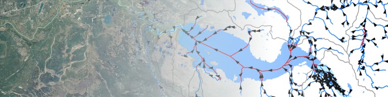
Anadromous Waters Catalog
It is estimated that less than half of Alaska’s freshwater salmon habitat is officially documented by the Alaska Department of Fish and Game, and until these streams and lakes are inventoried they will not be afforded certain protections under enacted Alaska Statute 16.05.871, “Protection of Fish and Game.” Additionally, often the actual locations of the streams in this database are inaccurate at the scale used for making decisions on individual parcels.
While the Alaska Department of Fish and Game is conducting efforts to update existing data and survey for previously undocumented habitat, there remains a vast number of water bodies in need of surveying and habitat use observations. And,
We now have newer technology to more accurately map these streams using a GPS, satellite image interpretation, and observations in the field. This project preserves salmon habitat through regulatory protection and directs our attention to new stream crossings that often pose potential barriers to salmon migration.
To learn more about Kenai Watershed Forum’s most recent work to document local freshwater salmon habitat, see our post on Water News Blog to find detailed maps and reports.
It is believed that less than 50% of the streams, rivers, and lakes actually used by anadromous species in Alaska are protected in the Catalog of Waters
Alaska Department of Fish and Game
Important for the Spawning, Rearing, or Migration of Anadromous Fishes“